Under mostly sunny skies, high temperatures will be within a degree or two of averages for February 4th, ranging from the 60s to lower 70s. Northerly winds of 10 to 20 mph with a few gusts to 30 mph can be expected.
Chances lean slightly towards a warmer than normal February. Chances also lean slightly towards a wetter than normal February for the Rio Grande Plains. There is greater uncertainty in conditions during the second half of the month.
February is often the driest month of the year. Arctic air can still reach the area. While still uncommon, icy or snowy weather occurs most frequently in February. Fire weather also becomes an increasing concern. Highs are typically in the 60s and 70s, with a few days with highs in the 80s typical. Lows are usually in the 40s to low 50s, and the last freeze of winter usually occurs in February for most. About 0.5 to 2 inches of precipitation (mostly rain) is typical with higher totals east. An ice or snow event occurs in some years, typically with light accumulations below an inch. For 2026, chances lean slightly towards a warmer than normal February. Chances also lean slightly towards a wetter than normal February for the Rio Grande Plains.
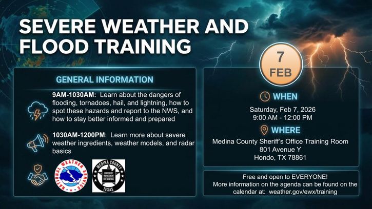
Interested in how to stay informed and prepared for severe weather and flooding and how to report these hazards to the NWS? We have a class in Hondo, TX on Feb 7th from 9 AM to 12 PM to help! Curious about other classes scheduled around the region? Visit: https://weather.gov/ewx/training


 Austin/San Antonio Radar
 Weather Map
 Satellite Imagery
 Del Rio Radar
 Digital Forecast Map
 Tropical Outlook
 Drought Status
 Air Quality
 Fire Weather Forecasts
 Observed Rainfall
 Observed Temperatures
 Daily Climate Graphs