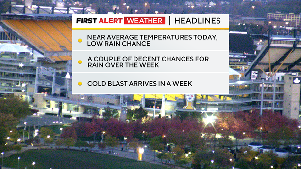
Low rain chance expected across Pittsburgh area Monday; fairly active pattern in place this week
This is one of those weeks where there are going to be several rain chances, so you'll want to keep the umbrella handy.
Any Alert Days Ahead? None for now.
Aware: Sunrise today is at 6:53 and sunset is at 5:15.
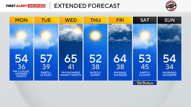
Monday's chance is minimal, with just a couple of sprinkles possible. Rain chances tick up on Wednesday, with places in the Laurel Highlands, the snow belt of Armstrong and Indiana counties, and north of I-80 with the best chance to see rain.
One of our better rain chances for the week will be Friday afternoon to Saturday morning with rain and storms, and maybe some light snow on Saturday morning near Erie.
Sunday morning will also see a brief storm chance with rain sticking around behind the storms through the remainder of the day.
Some data shows temperatures cool enough for either a wintry mix or light snow showers after sundown on Sunday night into Monday.
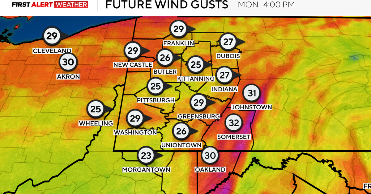
The good news is that temperatures are expected to remain a couple of degrees above freezing through the late evening on Monday. This should limit the impact of slick conditions on roads, but I would expect road crews will be out salting. While not as widespread, data at this point indicate that windy conditions will continue to increase the chance of some light snow or a wintry mix next Tuesday.
While light snow and winter weather are possible over the next week and a half, I have to caution that we are still right at or even more than a week out from this happening. There is plenty of time for things to change.
Often, when I see a forecast like this at this time of year, it tells me that the story isn't about the exact timing of the snow. It's to keep a close eye on the airmass that is bringing temperatures that are cold enough for snow. Someone is going to get it, and right now the bullseye is on us here in Pittsburgh. And at some point, that cold airmass will get here. The longer it takes, the colder the airmass will be.
WEATHER LINKS:
Current Conditions | School Closings & Delays | Submit Your Weather Photos
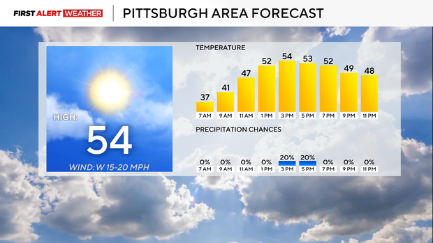
Getting back to Monday's forecast, I have high temperatures hitting the mid-50s with morning lows dipping down into the 30s.
Tuesday will look a lot like today with lows in the 30s and highs in the mid-50s. I have Wednesday as the warmest day of the week with highs hitting the mid-60s.
Another mid-60-degree day is expected on Friday. This weekend will see the coolest weather of the week, with highs in the mid-to-low 50s.
I have next Monday's high at just 39 degrees, though.
Speaking of winter weather, don't forget to check out the KDKA Winter Weather Forecast that premieres Monday at 5 p.m. on KDKA-TV.