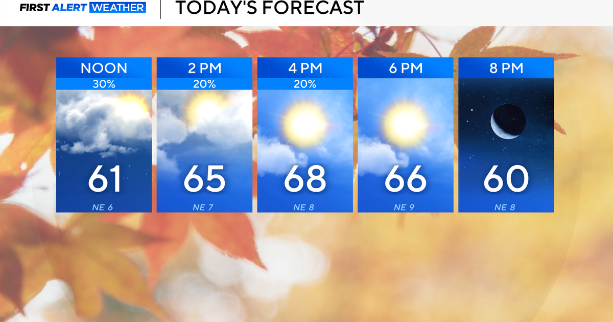
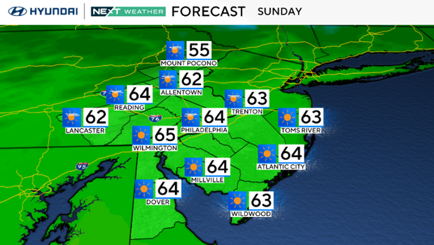
A pleasant Sunday with a light breeze in the Philadelphia area. Here's the weather forecast.
Hopefully you remembered to set those clocks back an hour last night and enjoyed the extra hour of sleep - unfortunately it means sunset Sunday night will be at 4:57pm!
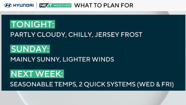
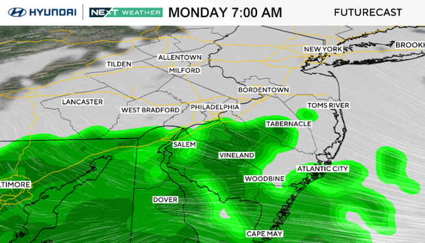
Today will be pleasant with a light southwest breeze and highs climbing into the 60s. Clouds increase Sunday night as a weak coastal low develops off the Mid-Atlantic. That system may bring a few showers from the city on southeast early tomorrow, but nothing too heavy or severe. It will just mean a gloomy, damp Monday commute in spots. A cold front then crosses Monday night, followed by a return to sunny and seasonable weather Tuesday.
That system may bring a few showers to southern New Jersey and Delaware on Monday, but nothing too heavy or severe. A cold front then crosses Monday night, followed by a return to sunny and seasonable weather Tuesday.
The rest of the week looks mainly quiet and comfortable under high pressure, with only a brief chance of light showers Wednesday night as a weak disturbance moves through. Temperatures will stay near normal for early November, and another cold front may approach late Friday before drier, cooler air settles in for next weekend.
Here's your 7-day forecast:
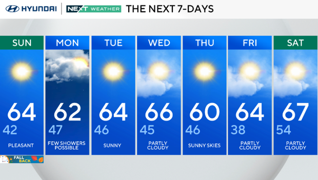
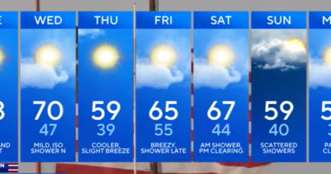
Sunday: Pleasant. High 64, Low 42.
Monday: Few showers possible. High 62, Low 47.
Tuesday: Sunny. High 64, Low 46.
Wednesday: Partly cloudy. High 66, Low 45.
Thursday: Sunny skies. High 60, Low 46.
Friday: Partly cloudy. High 64, Low 38.
Saturday: Partly cloudy. High 67, Low 54.