
Category:Unspec SVG created with QGIS
Media in category "Unspec SVG created with QGIS"
The following 200 files are in this category, out of 1,079 total.
(previous page) (next page)-
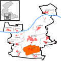
 Distribution of New Villages in Selangor.svg 1,112 × 1,211; 384 KB
-
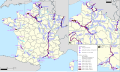
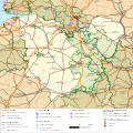
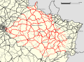
 Railway map of France - 10 - 2020 - fr - small.svg 564 × 914; 6.22 MB
-
 Spören in Zörbig.svg 641 × 651; 106 KB
-
 Jersleben in Niedere Börde.svg 699 × 700; 104 KB
-
 Railway map of France - 79 - 2020 - fr - small.svg 564 × 1,074; 7.28 MB
-
 Ramsin in Sandersdorf-Brehna.svg 726 × 687; 105 KB
-
 Transport map of France - 75-92-93-94.svg 1,488 × 1,453; 16.16 MB
-
 Königerode in Harzgerode.svg 1,052 × 744; 130 KB
-
 Könderitz in Elsteraue.svg 595 × 616; 142 KB
-
 Railway map of France - 54-57 - 1913 - fr - small.svg 811 × 1,126; 10.97 MB
-
 Railway map of France - 59 - 1880 - fr - small.svg 740 × 1,180; 9.83 MB
-
 Railway map of France - 33 - 2020 - fr - small.svg 1,273 × 879; 7.21 MB
-
 Railway map of France - 16 - 1920 - fr - small.svg 564 × 1,003; 4.91 MB
-
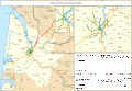
 Rail transport infrastructure map - France.svg 2,305 × 1,965; 66.63 MB
-
 Railway map of France - 55 - 1928 - fr - small.svg 564 × 1,109; 8 MB
-
 Water transport map of France - fr.svg 1,311 × 780; 76.3 MB
-
 Geusa in Merseburg.svg 570 × 548; 97 KB
-
 Plan agglomeration col ceyssat.svg 611 × 512; 2.07 MB
-
 Railway map of France - 2020 - en - small.svg 496 × 701; 16.02 MB
-
 Railway map of France - 54-57 - 1870 - fr - small.svg 811 × 1,126; 10.61 MB
-
 Railway map of France - 78 - 1850 - fr - small.svg 705 × 1,616; 11.64 MB
-
 Transport map of France - 47.svg 850 × 921; 7.56 MB
-
 Railway map of France - 75 - 1850 - fr - small.svg 564 × 1,020; 3.97 MB
-
 Railway map of France - BZH - 2020 - fr.svg 564 × 709; 6.76 MB
-
 Railway map of France - 58 - 1900 - fr - small.svg 564 × 1,020; 6.85 MB
-
 Huy-Neinstedt in Huy.svg 1,052 × 744; 150 KB
-
 Railway map of France - 11 - 1930 - fr - small.svg 705 × 914; 5.22 MB
-
 Transport map of France - 2A-2B.svg 673 × 1,346; 3.98 MB
-
 Railway map of France - 73 - 1950 - fr - small.svg 705 × 1,039; 6.81 MB
-
 Transport map of France - 16.svg 886 × 850; 6.41 MB
-
 Railway map of France - 22 - 2020 - fr - small.svg 705 × 914; 8.96 MB
-
 Railway map of France - 40 - 1900 - fr - small.svg 705 × 1,056; 5.4 MB
-
 Railway map of France - 46 - 1880 - fr - small.svg 564 × 985; 4.87 MB
-
 Railway map of France - 75 - 1980 - fr - small.svg 564 × 1,020; 4.46 MB
-
 Transport map of France - 60.svg 921 × 900; 9.9 MB
-
 Second Philippine Republic (orthographic projection).svg 512 × 512; 1.7 MB
-
 Republic of China edcp location map 1945 (disputed territories).svg 512 × 399; 7.43 MB
-
 PL - railway line 1.svg 803 × 747; 1.41 MB
-
 PL - railway line 19.svg 625 × 676; 250 KB
-
 PL - railway line 2.svg 809 × 747; 1.39 MB
-
 PL - railway line 20.svg 625 × 676; 261 KB
-
 PL - railway line 21.svg 739 × 770; 733 KB
-
 PL - railway line 23.svg 625 × 676; 255 KB
-
 PL - railway line 28.svg 739 × 770; 721 KB
-
 PL - railway line 29.svg 739 × 770; 717 KB
-
 PL - railway line 3.svg 803 × 747; 1.42 MB
-
 PL - railway line 34.svg 739 × 770; 718 KB
-
 PL - railway line 4.svg 803 × 747; 1.37 MB
-
 PL - railway line 42.svg 625 × 676; 259 KB
-
 PL - railway line 440.svg 625 × 676; 260 KB
-
 PL - railway line 445.svg 625 × 676; 262 KB
-
 PL - railway line 447.svg 739 × 770; 735 KB
-
 PL - railway line 448.svg 625 × 676; 258 KB
-
 PL - railway line 449.svg 625 × 676; 245 KB
-
 PL - railway line 45.svg 625 × 676; 255 KB
-
 PL - railway line 452.svg 625 × 676; 255 KB
-
 PL - railway line 457.svg 659 × 676; 254 KB
-
 PL - railway line 46.svg 625 × 676; 255 KB
-
 PL - railway line 47.svg 739 × 770; 749 KB
-
 PL - railway line 6.svg 803 × 747; 1.38 MB
-
 PL - railway line 7.svg 803 × 747; 1.41 MB
-
 PL - railway line 8.svg 803 × 747; 1.43 MB
-
 PL - railway line 9.svg 803 × 747; 1.45 MB
-
 Railway map of France - 86 - 1900 - fr - small.svg 564 × 1,074; 7.36 MB
-
 Reuden in Bitterfeld-Wolfen.svg 674 × 585; 112 KB
-
 Transport map of France - 63.svg 1,027 × 1,027; 10.49 MB
-
 Nationalist China 1945 (orthographic projection).svg 512 × 512; 1.72 MB
-
 Railway map of France - 54-57 - 1900 - fr - small.svg 811 × 1,126; 10.68 MB
-
 Districts of Harzgerode.svg 1,052 × 744; 130 KB
-
 Mengkiang (orthographic projection).svg 512 × 512; 1.72 MB
-
 Railway map of France - 88 - 1900 - fr - small.svg 705 × 861; 7.6 MB
-
 Railway map of France - 90 - 1870 - fr - small.svg 564 × 1,126; 3.3 MB
-

-
 Korea in Empire of Japan (orthographic projection).svg 512 × 512; 1.69 MB
-
 Passagem de Areia, Parnamirim (RN).svg 800 × 625; 55 KB
-
 Railway map of France - 47 - 2020 - fr - small.svg 564 × 968; 4.96 MB
-
 Japanese East Indies (orthographic projection).svg 512 × 512; 1.7 MB
-
 Japanese Hong Kong (orthographic projection).svg 512 × 512; 1.7 MB
-
 Karafuto in Empire of Japan (orthographic projection).svg 512 × 512; 1.7 MB
-
 Greater Asian Co-prosperity sphere (orthographic projection).svg 512 × 512; 1.69 MB
-
 Railway map of France - 67 - 1913 - fr - small.svg 564 × 1,020; 7.78 MB
-
 PL - railway line 501.svg 625 × 676; 261 KB
-
 PL - railway line 502.svg 625 × 676; 267 KB
-
 PL - railway line 503.svg 625 × 676; 266 KB
-
 Railway map of France - 41 - 1980 - fr - small.svg 705 × 985; 8.1 MB
-
 Railway map of France - 78 - 1950 - fr - small.svg 705 × 1,616; 12.98 MB
-
 Railway map of France - 13 - 2020 - fr - small.svg 705 × 1,109; 4.75 MB
-
 Manchukuo (orthographic projection).svg 512 × 512; 1.69 MB
-
 Railway map of France - 34 - 1860 - fr - small.svg 705 × 1,041; 5.1 MB
-
 Railway map of France - 74 - 1900 - fr - small.svg 564 × 1,039; 6.01 MB
-
 Parque do Jiqui, Parnamirim (RN).svg 800 × 625; 55 KB
-
 Railway map of France - 42 - 2020 - fr - small.svg 564 × 1,364; 8.3 MB
-
 Railway map of France - 59 - 2020 - fr - small.svg 740 × 1,180; 10.38 MB
-
 Railway map of France - 19 - 1900 - fr - small.svg 705 × 950; 5.32 MB
-
 Railway map of France - 76 - 1922 - fr - small.svg 705 × 1,126; 7.4 MB
-
 Transport map of France - 07.svg 744 × 1,205; 10.54 MB
-
 Railway map of France - 24 - 2020 - fr - small.svg 705 × 1,126; 6.11 MB
-
 Railway map of France - 73 - 1900 - fr - small.svg 705 × 1,039; 6.79 MB
-
 Railway map of France - 37 - 2020 - fr - small.svg 564 × 1,233; 7.85 MB
-
 Railway map of France - 13 - 1965 - fr - small.svg 705 × 1,109; 4.9 MB
-
 Railway map of France - 57 - 1930 - fr - small.svg 705 × 985; 8.77 MB
-
 Transport map of France - 81.svg 956 × 779; 7.47 MB
-
 Wang Chao-ming Nationalist China (orthographic projection).svg 512 × 512; 1.71 MB
-
 Railway map of France - 44 - 1932 - fr - small.svg 705 × 985; 8.77 MB
-
 Railway map of France - 73 - 1913 - fr - small.svg 705 × 1,039; 6.86 MB
-
 Vignobles alsace-fr.svg 744 × 1,052; 2.19 MB
-
 Railway map of France - 49 - 1930 - fr - small.svg 705 × 985; 9.71 MB
-
 Railway map of France - 51 - 1900 - fr - small.svg 740 × 1,020; 8.68 MB
-
 Railway map of France - 08 - 2020 - fr - small.svg 564 × 968; 6.51 MB
-
 Railway map of France - 29 - 1900 - fr - small.svg 564 × 1,056; 6.21 MB
-
 Railway map of France - 09 - 1900 - fr - small.svg 564 × 914; 4.21 MB
-
 Railway map of France - 26 - 2020 - fr - small.svg 564 × 1,109; 6.93 MB
-
 Railway map of France - 38 - 1860 - fr - small.svg 705 × 1,145; 8.2 MB
-
 Transport map of France - 27.svg 956 × 956; 8.94 MB
-
 Köthen in Köthen.svg 926 × 697; 82 KB
-
 Railway map of France - 07 - 2020 - fr - small.svg 564 × 1,091; 7.13 MB
-
 Railway map of France - 64 - 1980 - fr - small.svg 776 × 968; 5.71 MB
-
 Schönebeck in Schönebeck.svg 664 × 597; 105 KB
-
 Districts of Elsteraue.svg 595 × 616; 142 KB
-
 Rail transport infrastructure map - FR - Île-de-France.svg 2,268 × 1,020; 5.5 MB
-
 Railway map of France - 14 - 2020 - fr - small.svg 705 × 879; 6.88 MB
-
 Rail transport infrastructure map - FR - Bretagne.svg 983 × 511; 3.24 MB
-
 Rail transport infrastructure map - FR - Centre-Val de Loire.svg 907 × 775; 4.95 MB
-
 Rail transport infrastructure map - FR - Normandie.svg 1,059 × 680; 3.03 MB
-
 Rail transport infrastructure map - FR - Nouvelle-Aquitaine.svg 832 × 983; 7.39 MB
-
 Rail transport infrastructure map - FR - Occitanie.svg 812 × 793; 5.29 MB
-
 Rail transport infrastructure map - FR - Pays de la Loire.svg 945 × 699; 4.45 MB
-
 Railway map of France - 66 - 1980 - fr - small.svg 705 × 773; 3.98 MB
-
 Bobbau in Bitterfeld-Wolfen.svg 674 × 585; 112 KB
-
 Railway map of France - 06 - 1900 - fr - small.svg 705 × 1,410; 5.48 MB
-
 Railway map of France - 61 - 1930 - fr - small.svg 705 × 879; 7.21 MB
-
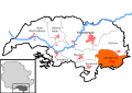
 Distribution of New Villages in Malaysia.svg 1,052 × 1,127; 1.41 MB
-
 Bitterfeld in Bitterfeld-Wolfen.svg 674 × 585; 112 KB
-
 Railway map of France - 54 - 1939 - fr - small.svg 705 × 1,091; 9.46 MB
-
 Beuna in Merseburg.svg 570 × 548; 97 KB
-
 Rail transport infrastructure map - UK - North East England.svg 756 × 869; 1.72 MB
-
 Railway map of France - 87 - 2020 - fr - small.svg 564 × 1,031; 4.85 MB
-
 Sounder commuter rail overview map.svg 945 × 1,512; 11.55 MB
-
 Rail transport infrastructure map - FR - Grand Est.svg 1,040 × 1,020; 14.63 MB
-
 Rail transport infrastructure map - FR - Hauts de France.svg 925 × 851; 8.21 MB
-
 Transport map of France - 66.svg 921 × 709; 3.62 MB
-
 Rail transport infrastructure map - FR - Auvergne-Rhône-Alpes.svg 1,323 × 1,172; 10.53 MB
-
 Sound Transit subareas map.svg 2,245 × 3,179; 10.01 MB
-
 Rail transport infrastructure map - FR - Bourgogne-Franche-Comté.svg 907 × 869; 8.52 MB
-
 Rail transport infrastructure map - FR - Provence-Alpes-Côte d'Azur.svg 756 × 869; 4.03 MB
-
 Katowice districts 1957.svg 600 × 600; 79 KB
-
 Railway map of France - 75 - 1913 - fr - small.svg 564 × 1,020; 4.25 MB
-
 Bad Salzelmen in Schönebeck.svg 664 × 597; 106 KB
-
 Railway map of France - 48 - 2020 - fr - small.svg 564 × 985; 4.42 MB
-
 Baasdorf in Köthen.svg 926 × 697; 83 KB
-
 Railway map of France - 13 - 1880 - fr - small.svg 705 × 1,109; 4.63 MB
-
 Railway map of France - 83 - 1880 - fr - small.svg 705 × 933; 6.02 MB
-
 Java location map plain.svg 1,153 × 522; 1.99 MB
-
 Pabstorf in Huy.svg 1,052 × 744; 150 KB
-
 Railway map of France - 43 - 1930 - fr - small.svg 705 × 914; 5.51 MB
-
 Railway map of France - 19 - 1980 - fr - small.svg 705 × 950; 5.42 MB
-
 Löbnitz in Köthen.svg 926 × 697; 82 KB
-
 Railway map of France - 1950 - fr - medium.svg 1,053 × 744; 23.42 MB
-
 Railway map of France - 974 - 1955 - fr - small.svg 564 × 914; 3.71 MB
-
 Railway map of France - 90 - 1930 - fr - small.svg 564 × 1,126; 3.41 MB
-
 Arensdorf in Köthen.svg 926 × 697; 82 KB
-
 Transport map of France - 54.svg 992 × 992; 10.57 MB
-
 Railway map of France - 61 - 1980 - fr - small.svg 705 × 879; 7.1 MB
-
 Aderstedt in Huy.svg 1,052 × 744; 150 KB
-
 Anderbeck in Huy.svg 1,052 × 744; 150 KB
-
 Badersleben in Huy.svg 1,052 × 744; 150 KB
-
 Dedeleben in Huy.svg 1,052 × 744; 150 KB
-
 Dingelstedt in Huy.svg 1,052 × 744; 150 KB
-
 Districts of Huy.svg 1,052 × 744; 150 KB
-
 Eilenstedt in Huy.svg 1,052 × 744; 150 KB
-
 Eilsdorf in Huy.svg 1,052 × 744; 150 KB
-
 Railway map of France - 50 - 1900 - fr - small.svg 564 × 1,126; 6.8 MB
-
 Railway map of France - 53 - 1980 - fr - small.svg 564 × 933; 7.17 MB
-
 Schlanstedt in Huy.svg 1,052 × 744; 150 KB
-
 Vogelsdorf in Huy.svg 1,052 × 744; 150 KB
-
 Early French railway companies - 1937 map - AL.svg 372 × 460; 1.08 MB
-
 Early French railway companies - 1937 map - Est.svg 815 × 602; 2.68 MB
-
 Early French railway companies - 1937 map - Midi.svg 850 × 673; 2.15 MB
-
 Early French railway companies - 1937 map - Nord.svg 478 × 478; 1.65 MB
-
 Early French railway companies - 1937 map - PLM.svg 850 × 1,205; 5.12 MB
-
 Early French railway companies - 1937 map - PO.svg 815 × 1,098; 4.75 MB
-
 Early French railway companies - 1937 map - État.svg 992 × 1,063; 5.35 MB
-
 Early French railway companies - 1937 map.svg 709 × 868; 16.45 MB
-
 Railway map of France - 01 - 1900 - fr - small.svg 564 × 1,020; 7.54 MB
-
 Railway map of France - 01 - 1930 - fr - small.svg 564 × 1,020; 7.8 MB
-
 Railway map of France - 01 - 1980 - fr - small.svg 564 × 1,020; 7.64 MB
-
 Railway map of France - 02 - 1900 - fr - small.svg 564 × 1,258; 8.09 MB
-
 Railway map of France - 02 - 1913 - fr - small.svg 564 × 1,258; 8.27 MB
-
 Railway map of France - 02 - 1935 - fr - small.svg 564 × 1,258; 8.25 MB
-
 Railway map of France - 02 - 1980 - fr - small.svg 564 × 1,258; 8.24 MB
-
 Railway map of France - 03 - 1900 - fr - small.svg 705 × 950; 7.5 MB
-
 Railway map of France - 03 - 1913 - fr - small.svg 705 × 950; 7.63 MB
-
 Railway map of France - 03 - 1930 - fr - small.svg 705 × 950; 7.64 MB
-
 Railway map of France - 03 - 1980 - fr - small.svg 705 × 950; 7.55 MB
-
 Railway map of France - 04 - 1900 - fr - small.svg 705 × 985; 6.82 MB
-
 Railway map of France - 04 - 1930 - fr - small.svg 705 × 985; 6.93 MB
-
 Railway map of France - 04 - 1980 - fr - small.svg 705 × 985; 6.9 MB
-
 Railway map of France - 05 - 1900 - fr - small.svg 705 × 1,020; 6.39 MB
-
 Railway map of France - 05 - 1930 - fr - small.svg 705 × 1,020; 6.47 MB
-
 Railway map of France - 05 - 1980 - fr - small.svg 705 × 1,020; 6.43 MB


.svg)
.svg)


.svg)


.svg)


.svg)
.svg)
.svg)

.svg)
.svg)
.svg)
.svg)


.svg)


.svg)


.svg)


