
Category:Spanish-language SVG maps
These maps should have a name ending with -es.
Subcategories
This category has the following 5 subcategories, out of 5 total.
Media in category "Spanish-language SVG maps"
The following 99 files are in this category, out of 99 total.
-
 2008 South Ossetia war es.svg 1,940 × 1,370; 849 KB
-
 Abkhazia ethnic map 2009 es.svg 1,008 × 786; 3.29 MB
-
 Abkhazia map-es.svg 1,008 × 786; 3.35 MB
-
 Aeroparque Jorge Newbery.svg 2,608 × 700; 205 KB
-
 Alanya map-es.svg 1,500 × 1,704; 76 KB
-
 Amón 830-es.svg 605 × 706; 63 KB
-
 Anaximander world map-es.svg 1,063 × 1,063; 14 KB
-
 Asteroid Belt es.svg 1,830 × 2,035; 762 KB
-
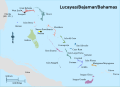 Bahamas regions map-es.svg 1,559 × 1,124; 857 KB
-
 Carte de la Bourgogne (Relief)-es.svg 803 × 889; 566 KB
-
 Centrales Nucleares-es.svg 800 × 480; 2.12 MB
-
 CIVETS-es.svg 940 × 477; 1.26 MB
-
 Climate-tipping-points-es.svg 2,479 × 1,409; 440 KB
-
 Denmark-es.svg 2,407 × 1,902; 226 KB
-
 Distribution map of Physalaemus nattereri-es.svg 991 × 741; 2.92 MB
-
 Division administrativa del Líbano.svg 424 × 599; 292 KB
-
 Edom 830-es.svg 605 × 706; 63 KB
-
 EIA World Shale Gas Map-es.svg 636 × 318; 1.87 MB
-
 Elephant Island map-es.svg 702 × 433; 68 KB
-
 Evolution Size of Surtsey-es.svg 2,081 × 1,911; 102 KB
-
 Falklands-Gondwana es.svg 519 × 435; 29 KB
-
 Fergana Valley political map-es.svg 840 × 629; 154 KB
-
 GDP-worldmap-2006-es.svg 940 × 477; 2.27 MB
-
 Geographic map of Somaliland-es.svg 4,110 × 2,600; 11.67 MB
-
 Geological map of Surtsey-es.svg 1,138 × 1,209; 352 KB
-
 Georgia, Ossetia, Russia and Abkhazia (es).svg 676 × 400; 101 KB
-
 Ghana - Location Map (2013) - GHA - UNOCHA-es.svg 1,817 × 1,817; 424 KB
-
 Gibraltar map-es.svg 2,020 × 3,140; 1.57 MB
-
 Grande Comore topographic map-es.svg 1,200 × 1,708; 1.29 MB
-
 Greater Limpopo Transfrontier Park sketch map-es.svg 2,007 × 2,000; 191 KB
-
 Guadalcanal & Florida Island map - es.svg 533 × 449; 377 KB
-
 Harz map-es.svg 10,084 × 5,973; 3.64 MB
-
 Hecataeus world map-es.svg 825 × 803; 66 KB
-
 Herodotus world map-es.svg 788 × 476; 309 KB
-
 Ile de Clipperton (carte-es).svg 2,070 × 1,686; 379 KB
-
 InteriorOfVenus-es.svg 915 × 647; 52 KB
-
 Israel map-DMSpositioning-es.svg 280 × 680; 39 KB
-
 JordanRiver es.svg 1,016 × 1,285; 860 KB
-
 King George Island map-es.svg 661 × 403; 200 KB
-
 Korea DMZ.svg 800 × 600; 62 KB
-
 Kosovo map-es.svg 1,777 × 1,830; 3.71 MB
-
 Laurasia-Gondwana-es.svg 519 × 435; 28 KB
-
 Levante 830-es.svg 646 × 753; 262 KB
-
 Liechtenstein topographic map-es.svg 1,301 × 1,697; 3.64 MB
-
 Lithuanian-Counties-named-es.svg 765 × 595; 645 KB
-
 Low-carbon-share-energy-es.svg 850 × 600; 174 KB
-
 Lower Galilee map-es.svg 600 × 493; 233 KB
-
 Macroscelides distribution map-es.svg 912 × 825; 60 KB
-
 Mapa de Corea primera invasion japonesa.svg 716 × 1,340; 434 KB
-
 Mapa de la Franja de Gaza.svg 725 × 888; 495 KB
-
 Mauritania Regions map-es.svg 2,558 × 2,907; 852 KB
-
 Moab 830-es.svg 605 × 706; 63 KB
-
 Moon names es.svg 512 × 384; 37 KB
-
 Moon names.svg 512 × 384; 73 KB
-
 Märket Island Political Map-es.svg 590 × 430; 49 KB
-
 Nemunas-es.svg 649 × 656; 1.76 MB
-
 New Silk Road -es.svg 1,174 × 647; 266 KB
-
 Nipdistricts-es.svg 1,116 × 953; 411 KB
-
 October 2023 Gaza−Israel conflict.svg 3,763 × 3,258; 9.27 MB
-
 Orthonectida anatomy - es.svg 670 × 636; 700 KB
-
 Pacific Ring of Fire-es.svg 781 × 472; 235 KB
-
 Petra location map-es.svg 1,330 × 2,000; 1.06 MB
-
 Placas tectonicas con limites detallados-es.svg 2,774 × 1,404; 1.3 MB
-
 Placas tectonicas es.svg 680 × 461; 360 KB
-
 Placas tectonicas limites detalla2-español.svg 5,213 × 2,638; 1.34 MB
-
 Placas tectonicas limites detallados-es.svg 4,170 × 2,111; 405 KB
-
 Placas tectonicas mayores.svg 4,152 × 2,838; 239 KB
-
 Placas tectonicas2-es.svg 4,167 × 2,844; 231 KB
-
 Playa de Las Centeras-Dinámica de arenas.svg 406 × 306; 171 KB
-
 Primer viaje de Colón.svg 1,715 × 1,149; 243 KB
-
 Real Expedición Filantrópica de la Vacuna 01.svg 1,052 × 744; 1.5 MB
-
 Real Expedición Filantrópica de la Vacuna.svg 1,994 × 1,012; 3.76 MB
-
 Saint-Martin Island map-es.svg 1,102 × 830; 1.87 MB
-
 Saint-Paul and Amsterdam Islands map-es.svg 2,330 × 2,597; 1.51 MB
-
 San Marino relief map-es.svg 2,242 × 2,557; 3.61 MB
-
 Segundo viaje de Colón.svg 1,715 × 1,149; 244 KB
-
 Sinai Peninsula - es-2.svg 1,060 × 1,766; 2.25 MB
-
 Sistema Iberoamericano.svg 3,121 × 1,586; 2.59 MB
-
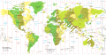 Standard time zones of the world (2012)-es.svg 1,672 × 856; 1.41 MB
-
 Suicide rates map es.svg 940 × 477; 2.26 MB
-
 Tercer viaje de Colón.svg 1,715 × 1,149; 243 KB
-
 Thermopylae map 480bc-es.svg 676 × 520; 39 KB
-
 Top Gear test track-es.svg 1,009 × 779; 60 KB
-
 Topographic map of Surtsey-es.svg 2,453 × 1,911; 853 KB
-
 Topographic-map-of-Montserrat-es.svg 744 × 1,052; 265 KB
-
 Tromelin-topo-es.svg 3,810 × 2,611; 200 KB
-
 Tunis Gulf topo map-es.svg 1,990 × 1,800; 5.5 MB
-
 Uranus cutaway-es.svg 720 × 540; 43 KB
-
 Verfassungsreferendum in Italien 2016 weltweit-es.svg 1,597 × 873; 1.21 MB
-
 Viajes de colon.svg 1,715 × 1,149; 266 KB
-
 Vindobona 250-300.es.svg 1,116 × 1,068; 265 KB
-
 Vuelo Gago Coutinho y Sacadura Cabral.svg 556 × 625; 34 KB
-
 Vuelo plus ultra.svg 556 × 625; 47 KB
-
 Vuelos plus ultra y Gago Coutinho-Sacadura Cabral.svg 556 × 625; 40 KB
-
 World alphabets & writing systems ES.svg 2,714 × 1,256; 2.91 MB
-
 WritingSystemsOfTheWorld es SistemasEscrituraMundo.svg 1,684 × 1,055; 650 KB
-
 WritingSystemsOfTheWorld-es.svg 1,684 × 1,055; 693 KB
-
 ZEE-UE-es.svg 940 × 427; 1.49 MB
-
 Åland Märket Location-es.svg 996 × 1,004; 223 KB


-es.svg)


.svg)
_-_GHA_-_UNOCHA-es.svg)


.svg)


-es.svg)


