
Category:SVG transport maps of Brazil
Media in category "SVG transport maps of Brazil"
The following 12 files are in this category, out of 12 total.
-
 Anhembi.svg 627 × 283; 65 KB
-
 Areas da sp trans.svg 1,052 × 744; 1.07 MB
-
 Belo horizonte1.svg 782 × 651; 32 KB
-
 Brasilia Metro Map.svg 871 × 649; 357 KB
-
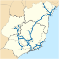 Ferrovia Centro Atlântica network map.svg 299 × 298; 1.57 MB
-
 Ferrovias da Bahia.svg 886 × 918; 244 KB
-
 Fortaleza 2014.svg 800 × 803; 25 KB
-
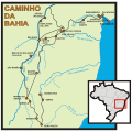 Mapa caminhos da Bahia.svg 650 × 647; 248 KB
-
 Mapa dos sistemas ferroviários urbanos do Brasil.svg 780 × 687; 592 KB
-
 Metro rio geographical network 2015 .svg 1,024 × 1,008; 23 KB
-
 Railway network Brazil.svg 702 × 687; 4.1 MB
-
 Transnordestina Logistica network map.svg 614 × 687; 445 KB


