
Category:SVG maps of the Americas
Temperate regions: Americas · North America · South America · Africa · Europe · Asia · Oceania – Polar regions: Antarctica · Arctic – Other regions: Afro-Eurasia · Eurasia
Subcategories
This category has the following 59 subcategories, out of 59 total.
A
B
C
E
F
G
H
I
L
M
P
S
T
Media in category "SVG maps of the Americas"
The following 47 files are in this category, out of 47 total.
-
 2023 south american summit nations.svg 389 × 377; 625 KB
-
 Age of consent - America.svg 512 × 499; 404 KB
-
 Amblyomma americanum range map.svg 389 × 377; 695 KB
-
 Amblyomma cajennense range map.svg 389 × 377; 667 KB
-
 Ameerika-maailmajagu.svg 874 × 444; 521 KB
-
 America location map with borders.svg 400 × 350; 173 KB
-
 America map - Pact of Bogotá (signatures and ratifications).svg 1,945 × 1,885; 535 KB
-
 America map.svg 389 × 377; 646 KB
-
 America-Spanish Kingdoms-1620.svg 1,945 × 1,885; 559 KB
-
 American countries by population, 2020.svg 450 × 612; 593 KB
-
 Americas (orthographic projection) blank.svg 550 × 550; 73 KB
-
 Americas (orthographic projection).svg 550 × 550; 332 KB
-
 Americas laea location map with borders.svg 2,655 × 3,000; 1.6 MB
-
 Americas location map with borders.svg 1,259 × 1,102; 2.33 MB
-
 Americas Secondary Political Divisions map.svg 1,016 × 1,063; 1.09 MB
-
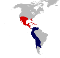
 América Central ubicación 2.svg 1,326 × 780; 2.17 MB
-
 América Central ubicación.svg 170 × 119; 615 KB
-
 Aridoamerica (orthographic projection).svg 541 × 541; 376 KB
-
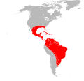
 Association of Caribbean States membership.svg 492 × 352; 1.05 MB
-
 Australia map, States-simple.svg 200 × 186; 16 KB
-
 Belém do Pará Convention participation map.svg 1,945 × 1,885; 634 KB
-
 Europien territories of Americas.svg 2,392 × 3,032; 1,007 KB
-
 FIBA Americas zones.svg 389 × 377; 453 KB
-
 Gender self-identification in the Americas.svg 384 × 387; 610 KB
-
 H1N1 America map by confirmed cases.svg 1,945 × 1,885; 686 KB
-
 H1N1 America map by deaths.svg 1,945 × 1,885; 724 KB
-
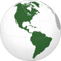
 Latin America (orthographic projection).svg 550 × 550; 510 KB
-
 Latin American Countries by HDI (2008).svg 629 × 810; 164 KB
-
 Latinameriko.svg 1,064 × 1,201; 445 KB
-
 Lima Group map.svg 363 × 353; 623 KB
-
 Map of World Heritage Sites in the Americas.svg 389 × 377; 634 KB
-
 Montevideo Convention parties.svg 389 × 377; 617 KB
-
 OpCondorParticipantsMap.svg 200 × 300; 315 KB
-
 Pan American Sports Organization (PASO) members.svg 387 × 377; 548 KB
-
 Political map of America - blank.svg 878 × 1,192; 581 KB
-
 Pre-clovis-sites-of-the-americas.svg 536 × 536; 489 KB
-
 Pre-clovis-sites-of-the-western-americas.svg 536 × 536; 478 KB
-
 Regulation of electronic cigarettes Americas.svg 597 × 548; 3.08 MB
-
 Rio Pact (orthographic projection).svg 550 × 550; 1.09 MB
-
 Simarouba amara distribution.svg 300 × 377; 300 KB
-
 South America location blue.svg 463 × 236; 254 KB
-
 States and territories of Americas 2024.svg 3,189 × 4,043; 667 KB
-
 States and territories of Americas 2025.svg 3,189 × 4,043; 668 KB
-
 States and territories of Americas.svg 2,392 × 3,032; 917 KB
-
 Troika of Tryanny map.svg 363 × 353; 571 KB
-
 United States involvement in regime change in Latin America.svg 375 × 370; 426 KB
-
 US states with ids.svg 800 × 698; 128 KB


.svg)


.svg)


.svg)


.svg)
.svg)


_members.svg)


.svg)


