
Category:SVG locator maps of Wales
Subcategories
This category has the following 2 subcategories, out of 2 total.
S
- SVG maps of Celtic nations (11 F)
Media in category "SVG locator maps of Wales"
The following 61 files are in this category, out of 61 total.
-
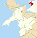
 Blaenau Gwent UK location map.svg 990 × 1,266; 407 KB
-
 Blaenau Gwent UK map.svg 990 × 1,266; 227 KB
-
 Bridgend UK location map.svg 1,273 × 1,266; 541 KB
-
 Bridgend UK map.svg 1,273 × 1,266; 267 KB
-
 British Isles United Kingdom WA highlighted.svg 675 × 1,180; 236 KB
-
 British Isles Wales.svg 675 × 1,180; 142 KB
-
 Caerphilly UK community map (BTM).svg 894 × 1,266; 474 KB
-
 Caerphilly UK location map.svg 894 × 1,266; 625 KB
-
 Caerphilly UK map.svg 894 × 1,266; 310 KB
-
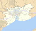
 Cardiff UK location map.svg 1,187 × 1,266; 464 KB
-
 Cardiff UK map.svg 1,187 × 1,266; 299 KB
-
 Carmarthenshire UK location map.svg 1,425 × 1,111; 1.29 MB
-
 Carmarthenshire UK map.svg 1,425 × 1,111; 803 KB
-
 Ceredigion UK location map.svg 1,425 × 1,192; 799 KB
-
 Ceredigion UK map.svg 1,425 × 1,192; 526 KB
-
 Clwyd South (Assembly constituency).svg 1,015 × 513; 63 KB
-
 Conwy UK location map.svg 1,425 × 1,275; 731 KB
-
 Conwy UK map.svg 1,425 × 1,275; 490 KB
-
 Denbighshire UK location map.svg 864 × 1,305; 767 KB
-
 Denbighshire UK map.svg 864 × 1,305; 474 KB
-
 Flintshire UK location map.svg 1,177 × 1,305; 758 KB
-
 Flintshire UK map.svg 1,177 × 1,305; 405 KB
-
 Gwynedd UK location map.svg 1,275 × 1,305; 1.12 MB
-
 Gwynedd UK map.svg 1,275 × 1,305; 822 KB
-
 Isle of Anglesey UK location map.svg 1,425 × 1,255; 793 KB
-
 Isle of Anglesey UK map.svg 1,425 × 1,255; 633 KB
-
 LocationWales.svg 1,000 × 500; 2.76 MB
-
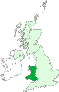 Map of Wales within the United Kingdom.svg 616 × 955; 125 KB
-
 Merthyr Tydfil UK location map.svg 942 × 1,266; 380 KB
-
 Merthyr Tydfil UK map.svg 942 × 1,266; 222 KB
-
 Monmouth location.svg 950 × 1,266; 1,021 KB
-
 Monmouthshire UK location map.svg 950 × 1,266; 1,019 KB
-
 Monmouthshire UK map.svg 950 × 1,266; 594 KB
-
 Neath Port Talbot UK location map.svg 973 × 1,266; 679 KB
-
 Neath Port Talbot UK map.svg 973 × 1,266; 351 KB
-
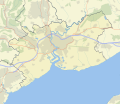
 Newport UK location map.svg 1,425 × 1,233; 577 KB
-
 Newport UK map roads and areas 2.svg 1,425 × 1,233; 483 KB
-
 Newport UK map roads and areas 3.svg 1,425 × 1,233; 482 KB
-
 Newport UK map roads and areas 3m1.svg 1,425 × 1,233; 482 KB
-
 Newport UK map roads and areas.svg 1,425 × 1,233; 483 KB
-
 Newport UK map.svg 1,425 × 1,233; 404 KB
-
 North Wales (National Assembly for Wales electoral region).svg 1,000 × 1,223; 130 KB
-
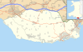
 Pembrokeshire UK location map.svg 1,425 × 1,095; 1.06 MB
-
 Pembrokeshire UK map.svg 1,425 × 1,095; 837 KB
-
 Powys UK location map.svg 924 × 1,305; 1.75 MB
-
 Powys UK map.svg 924 × 1,305; 785 KB
-
 Rhondda Cynon Taf UK location map.svg 879 × 1,266; 733 KB
-
 Rhondda Cynon Taf UK map.svg 879 × 1,266; 337 KB
-
 Swansea UK location map.svg 1,372 × 1,266; 886 KB
-
 Swansea UK map.svg 1,372 × 1,266; 590 KB
-
 Torfaen UK location map with towns.svg 1,187 × 1,266; 499 KB
-
 Torfaen UK location map.svg 1,187 × 1,266; 496 KB
-
 Torfaen UK map.svg 1,187 × 1,266; 297 KB
-
 Vale of Glamorgan UK location map.svg 1,425 × 895; 583 KB
-
 Vale of Glamorgan UK map.svg 1,425 × 895; 312 KB
-
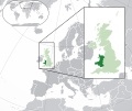 Wales in the UK and Europe.svg 2,045 × 1,720; 7.84 MB
-
 Wales location map subdivisions 1996.svg 512 × 822; 2.67 MB
-
 Wales location map.svg 1,047 × 1,251; 69 KB
-
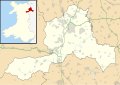
 Wales Powys UA boundary overlay.svg 1,090 × 1,315; 115 KB
-
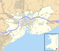
 Wrexham UK location map.svg 1,425 × 1,008; 631 KB
-
 Wrexham UK map.svg 1,425 × 1,008; 346 KB


.svg)


.svg)


.svg)


