
Category:Maps of Molsheim
Wikimedia category | |||||
| Upload media | |||||
| Instance of | |||||
|---|---|---|---|---|---|
| Category combines topics | |||||
| Molsheim | |||||
commune in Bas-Rhin, France  Radnice   | |||||
| Pronunciation audio | ⓘ | ||||
| Instance of | |||||
| Location | |||||
| Population |
| ||||
| Area |
| ||||
| Elevation above sea level |
| ||||
| official website | |||||
 | |||||
Media in category "Maps of Molsheim"
The following 13 files are in this category, out of 13 total.
-
 120 (A) Cadastre napoléonien.jpg 2,646 × 1,764; 1.65 MB
-
 120 (B) Cadastre napoléonien (avec N°).jpg 2,835 × 1,890; 1.75 MB
-
 67300-Molsheim-Hydro.jpeg 5,846 × 4,133; 2.29 MB
-
 67300-Molsheim-Sols.png 3,270 × 2,598; 3.02 MB
-
 Arrondissement de Molsheim.PNG 388 × 480; 12 KB
-
 Cloitre-molsheim.jpg 1,150 × 1,210; 2.67 MB
-
 Guerre des Evêques-1592-Chartreuse de Molsheim.jpg 2,584 × 1,996; 2.18 MB
-
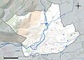
 Map commune FR insee code 67300.png 756 × 605; 64 KB
-
 Molsheim (Arrondissement) Plan.svg 450 × 509; 100 KB
-

-
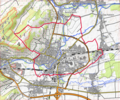
 Molsheim OSM 01.png 556 × 462; 167 KB
-
 Molsheim OSM 02.png 556 × 462; 296 KB
-
 Siege of Molsheim (1610).jpg 1,280 × 1,015; 729 KB
_Cadastre_napol%C3%A9onien.jpg)
_Cadastre_napol%C3%A9onien_(avec_N%C2%B0).jpg)


_Plan.svg)


.jpg)