
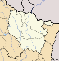
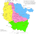
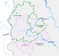
Category:Maps of Lorraine
Administrative regions and territorial collectivity of Metropolitan France (‡ since start of 2016):
Auvergne-Rhône-Alpes‡ · Bourgogne-Franche-Comté‡ · Brittany · Centre-Val de Loire · Corsica · Grand Est‡ · Hauts-de-France‡ · Île-de-France · Normandy‡ · Nouvelle-Aquitaine‡ · Occitania‡ · Pays de la Loire · Provence-Alpes-Côte d'Azur
Former administrative regions of Metropolitan France (until end of 2015):
Alsace · Aquitaine · Auvergne · Burgundy · Champagne-Ardenne · Franche-Comté · Languedoc-Roussillon · Limousin · Lorraine · Midi-Pyrénées · Nord-Pas-de-Calais · Lower Normandy · Upper Normandy · Picardy · Poitou-Charentes · Rhône-Alpes
Overseas departments and regions: Guadeloupe · Martinique · French Guiana · Réunion · Mayotte
Overseas collectivities: Saint Barthélemy · Saint-Martin · Saint Pierre and Miquelon · French Polynesia · Wallis and Futuna · French Southern and Antarctic Lands+
Sui generis territories: New Caledonia · Clipperton Island+
Use the appropriate category for maps showing all or a large part of Lorraine. See subcategories for smaller areas:
| If the map shows | Category to use |
|---|---|
| Lorraine on a recently created map | Category:Maps of Lorraine or its subcategories |
| Lorraine on a map created more than 70 years ago | Category:Old maps of Lorraine or its subcategories |
| the history of Lorraine on a recently created map | Category:Maps of the history of Lorraine or its subcategories |
| the history of Lorraine on a map created more than 70 years ago | Category:Old maps of the history of Lorraine or its subcategories |

Wikimedia category | |||||
| Upload media | |||||
| Instance of | |||||
|---|---|---|---|---|---|
| Category combines topics | |||||
| Lorraine | |||||
cultural region in France  Katedralen i Metz     | |||||
| Instance of | |||||
| Named after | |||||
| Patron saint | |||||
| Location | metropolitan France, France | ||||
| Capital | |||||
| Executive body | |||||
| End time |
| ||||
| Highest point | |||||
| Population |
| ||||
| Area |
| ||||
| Different from | |||||
 | |||||
Subcategories
This category has the following 13 subcategories, out of 13 total.
Media in category "Maps of Lorraine"
The following 54 files are in this category, out of 54 total.
-
 474x488-Carte-Loraine-A.svg 474 × 488; 59 KB
-
 474x488-Carte-Loraine-R.png 474 × 488; 381 KB
-
 Alsace-Lorraine, Luxembourg, Bords du Rhin - btv1b53121320d.jpg 7,758 × 11,532; 17.6 MB
-

-

-
 Carte de la mairie de Bruyères, Lorraine.gif 1,123 × 816; 68 KB
-
 Carte du bailliage de Bruyères, Lorraine.gif 1,123 × 816; 75 KB
-
 Carte gastronomique de la France-1929-Lorraine.jpg 1,674 × 1,645; 1.15 MB
-
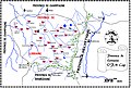
 Carte Lorraine 2018.png 2,000 × 1,922; 629 KB
-
 Carte prévôté Bruyères.gif 1,123 × 816; 92 KB
-
 Comptoirs lombards en Lorraine.gif 647 × 621; 38 KB
-
 Contours du Toulois selon différentes époques.jpg 729 × 692; 81 KB
-
 Départements et districts de Lorraine et d'Alsace - par M. Bonne... - btv1b10223004n.jpg 4,724 × 3,334; 3.5 MB
-
 Emblem SaarLorLux.png 402 × 328; 8 KB
-

-

-

-

-
 Gouvernements créés par les Prussiens 1870-71.jpg 1,654 × 1,248; 730 KB
-

-

-

-

-

-
 La Lorraine et l'Alsace - par P. Duval, Geographe du Roy - btv1b8491596g.jpg 8,743 × 6,595; 9.45 MB
-
 La Lorraine et l'Alsace - par P. Duval, Geographe du Roy - btv1b84930044.jpg 8,736 × 6,444; 8.89 MB
-
 LASB K Hellwig 0091.jpg 8,270 × 6,570; 4.33 MB
-
 LASB K Hellwig 0710.jpg 4,367 × 3,225; 3.09 MB
-
 LASB K Hellwig 0724.jpg 1,884 × 1,518; 797 KB
-
 Les bonhomme de la Saint-Nicolas.png 939 × 775; 500 KB
-
 Lorraine geologic map andra.svg 1,300 × 1,300; 338 KB
-
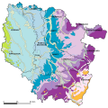 Lorraine geologic map.svg 1,300 × 1,300; 358 KB
-
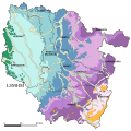
 Lorraine hydrologic map.svg 1,580 × 1,300; 264 KB
-
 Lorraine-Corine.jpg 1,050 × 1,053; 466 KB
-
 Lorraine. Alsace - par Jean-Baptiste Bourguignon d'Anville - btv1b53009131c.jpg 4,432 × 3,634; 2.62 MB
-
 Lorrainelangue.png 158 × 157; 3 KB
-

-

-
 PaysBasFR.svg 731 × 505; 2.18 MB
-
 Province capucine de Lorraine.jpg 2,492 × 1,684; 1.43 MB
-
 RC Strasbourg et clubs rivaux map-fr.svg 916 × 687; 89 KB
-
 Sillon Lorrain AUF.jpg 1,063 × 1,651; 929 KB
-

-

-
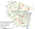
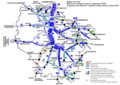
 TER Lorraine, carte du réseau.png 2,165 × 2,123; 8.39 MB
-
 TER Lorraine, carte du réseau.svg 2,162 × 2,123; 11.2 MB
-
 TER Lorraine, fréquence de la desserte.png 1,492 × 1,053; 536 KB
-
 TER Lorraine, fréquence le dimanche.png 1,492 × 1,053; 472 KB
-
 TER Lothringen.png 630 × 464; 47 KB
-
 Uebersichtskarte der Eisenerzfelder des Westlichen Deutsch-Lothringen - btv1b10224903z.jpg 7,951 × 11,802; 16.86 MB
-
 Variations de la frontière d'Alsace-Lorraine - btv1b53079327k.jpg 5,703 × 4,201; 5.36 MB
-
 Villes affranchies loi Beaumont.gif 647 × 621; 22 KB
-
 Villes-étappes prussiennes 1871.jpg 2,222 × 1,681; 1.24 MB
-


.jpg)
.jpg)


_Abteilung_der_K%C3%B6nigl(ichen)_Preuss(ischen)_Landesaufnahme._Blatt_584,_Solgne_-_btv1b102238054.jpg)
_Abteilung_der_K%C3%B6nigl(ichen)_Preuss(ischen)_Landesaufnahme._Blatt_586,_Pfalzburg_-_btv1b10223798t.jpg)
_Abteilung_der_K%C3%B6nigl(ichen)_Preuss(ischen)_Landesaufnahme._Blatt_600,_Bourdonnaye_-_btv1b102237941.jpg)
_Auflage)_-_herausgegeben_von_der_Kartogr._Abteilung_der_K%C3%B6nigl._Preuss._Landesaufnahme_-_btv1b102235948.jpg)
_Auflage)_-_herausgegeben_von_der_Kartogr._Abteilung_der_K%C3%B6nigl._Preuss._Landesaufnahme_-_btv1b10223601k.jpg)


Charles_III_btv1b531527223_2.jpg)
_-_von_Lothringen_nach_amtlichen_Quellen_bearbeitet_von_Heinrich_Rothenberger_-_btv1b530212127.jpg)


