
Category:Maps of DeKalb County, Georgia
Wikimedia category | |||||
| Upload media | |||||
| Instance of | |||||
|---|---|---|---|---|---|
| Category combines topics | |||||
| DeKalb County | |||||
county in Georgia, United States   | |||||
| Instance of | |||||
| Named after | |||||
| Location | Georgia | ||||
| Capital | |||||
| Headquarters location | |||||
| Inception |
| ||||
| Highest point | |||||
| Population |
| ||||
| Area |
| ||||
| Different from | |||||
| official website | |||||
 | |||||
Counties of Georgia: Appling · Atkinson · Bacon · Baker · Baldwin · Banks · Barrow · Bartow · Ben Hill · Berrien · Bleckley · Brantley · Brooks · Bryan · Bulloch · Burke · Butts · Calhoun · Camden · Campbell · Candler · Carroll · Catoosa · Charlton · Chatham · Chattooga · Cherokee · Clay · Clayton · Clinch · Cobb · Coffee · Colquitt · Columbia · Cook · Coweta · Crawford · Crisp · Dade · Dawson · Decatur · DeKalb · Dodge · Dooly · Dougherty · Douglas · Early · Effingham · Elbert · Emanuel · Evans · Fannin · Fayette · Floyd · Forsyth · Franklin · Fulton · Gilmer · Glascock · Glynn · Gordon · Grady · Greene · Gwinnett · Habersham · Hall · Hancock · Haralson · Harris · Hart · Heard · Henry · Houston · Irwin · Jackson · Jasper · Jeff Davis · Jefferson · Jenkins · Johnson · Jones · Lamar · Lanier · Laurens · Lee · Liberty · Lincoln · Long · Lowndes · Lumpkin · Macon · Madison · Marion · McDuffie · McIntosh · Meriwether · Miller · Milton · Mitchell · Monroe · Montgomery · Morgan · Murray · Newton · Oconee · Oglethorpe · Paulding · Peach · Pickens · Pierce · Pike · Polk · Pulaski · Putnam · Rabun · Randolph · Rockdale · Schley · Screven · Seminole · Spalding · Stephens · Stewart · Sumter · Talbot · Taliaferro · Tattnall · Taylor · Telfair · Terrell · Thomas · Tift · Toombs · Towns · Treutlen · Troup · Turner · Twiggs · Union · Upson · Walker · Walton · Ware · Warren · Washington · Wayne · Wheeler · White · Whitfield · Wilcox · Wilkes · Wilkinson · Worth
City-counties: Athens–Clarke · Augusta–Richmond · Columbus–Muscogee · Cusseta–Chattahoochee · Georgetown–Quitman · Macon–Bibb · Preston–Webster · Statenville–Echols
City-counties: Athens–Clarke · Augusta–Richmond · Columbus–Muscogee · Cusseta–Chattahoochee · Georgetown–Quitman · Macon–Bibb · Preston–Webster · Statenville–Echols
Subcategories
This category has the following 2 subcategories, out of 2 total.
A
O
Media in category "Maps of DeKalb County, Georgia"
The following 52 files are in this category, out of 52 total.
-
 Atlanta-suburbs.png 1,266 × 1,597; 415 KB
-

-

-
 Census 2000 Block Map DeKalb County, Georgia, United States.jpg 2,082 × 2,900; 2.02 MB
-

-
-

-

-
-

-

-

-

-

-

-

-

-

-

-

-

-

-

-
-

-

-

-

-

-

-

-

-

-

-

-

-

-

-

-

-

-
 GAMap-doton-Lithonia.PNG 258 × 300; 19 KB
-
 GAMap-doton-NorthAtlanta.PNG 258 × 300; 19 KB
-
 GAMap-doton-PineLake.PNG 258 × 300; 19 KB
-
 GAMap-doton-Redan.PNG 258 × 300; 19 KB
-
 GAMap-doton-Scottdale.PNG 258 × 300; 19 KB
-
 Map of Georgia highlighting DeKalb County.svg 740 × 857; 398 KB
-
 Map of Northwoods Historic District in DeKalb County, Georgia.pdf 1,275 × 1,650; 214 KB
-
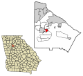
 Tucker GA CCD 93096.jpg 712 × 624; 169 KB
-
 Tucker Georgia Creeks and Streams.jpg 502 × 425; 197 KB
-
 Tucker Georgia Geological Survey 1964.jpg 568 × 624; 213 KB
-
 Tucker, Georgia Interstate and Highway Exits.jpg 837 × 800; 529 KB


