
Category:Maps of Abkhazia
Wikimedia category | |||||
| Upload media | |||||
| Instance of | |||||
|---|---|---|---|---|---|
| Category combines topics | |||||
| Abkhazia | |||||
disputed territory in the South Caucasus, whose recognition as a country is limited    | |||||
| Pronunciation audio | ⓘ | ||||
| Instance of | |||||
| Location | Caucasus, Caucasus Mountains | ||||
| Located in or next to body of water | |||||
| Capital | |||||
| Has part(s) |
| ||||
| Significant event |
| ||||
| Highest point | |||||
| Population |
| ||||
| Area |
| ||||
| Different from | |||||
 | |||||
- See also Category:Maps of Georgia
Subcategories
This category has the following 17 subcategories, out of 17 total.
- Flag maps of Abkhazia (16 F)
- Maps of Abkhazia on stamps (22 F)
*
L
M
P
S
- Maps of Sukhumi (8 F)
T
- Topographic maps of Abkhazia (27 F)
- Travel maps of Abkhazia (2 F)
Pages in category "Maps of Abkhazia"
This category contains only the following page.
Media in category "Maps of Abkhazia"
The following 92 files are in this category, out of 92 total.
-
 Caucasus region Ovest.jpg 651 × 632; 94 KB
-
 Abaza Kral.jpg 859 × 444; 75 KB
-
 Abaza-Abkhaz language official status map.svg 710 × 405; 671 KB
-
 Abazia(Grand Abazia).jpg 2,160 × 1,582; 1.38 MB
-
 Abchazja a mapa.png 714 × 535; 67 KB
-
 Abchazja.jpg 487 × 334; 95 KB
-
 Abcházie.png 810 × 769; 71 KB
-
 Abgarkhuk.JPG 942 × 1,140; 104 KB
-
 Abhazya Türkleri Dağılımı.png 572 × 436; 41 KB
-
 Abkh-satellite.jpg 704 × 568; 58 KB
-
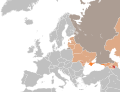
 Abkhazia and South Ossetia international recognition.svg 2,754 × 1,398; 1.11 MB
-
 Abkhazia and South Ossetia recognition.svg 2,754 × 1,398; 1.1 MB
-
 Abkhazia and South Ossetia relations-2008-05-09.png 1,357 × 628; 56 KB
-
 Abkhazia and South Ossetia relations.png 1,357 × 628; 37 KB
-
 Abkhazia detail map (ka).png 600 × 450; 77 KB
-
 Abkhazia detail map in portuguese.PNG 600 × 450; 38 KB
-
 Abkhazia detail map original.png 600 × 450; 36 KB
-
 Abkhazia detail map.png 600 × 450; 30 KB
-
 Abkhazia detail map2 Spanish.png 600 × 450; 96 KB
-
 Abkhazia detail map2.png 600 × 450; 87 KB
-
 Abkhazia detail map3.jpg 600 × 450; 83 KB
-
 Abkhazia detail map3.png 600 × 450; 274 KB
-
 Abkhazia detail map4.jpg 600 × 450; 82 KB
-
 Abkhazia detail mapwr.png 290 × 218; 64 KB
-
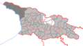
 Abkhazia Regions map2.svg 722 × 592; 205 KB
-
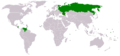
 Abkhazia Russia Locator.svg 2,045 × 1,720; 7.47 MB
-
 Abkhazia stub.png 2,000 × 1,520; 92 KB
-
 Abkhazia summary map.png 250 × 185; 26 KB
-
 Abkhazia-South Ossetia relations.svg 940 × 477; 1.66 MB
-
 Abkhazia.png 550 × 437; 31 KB
-
 Abkhazia02.png 868 × 694; 41 KB
-
 Abcházie mapa.png 868 × 694; 30 KB
-
 AbkhaziaGeorgiaBlank.jpg 350 × 308; 43 KB
-
 AbkhaziaGeorgiaBlank.png 600 × 450; 40 KB
-
 AbkhaziaGeorgiaEng.jpg 405 × 310; 29 KB
-
 AbkhaziaGeorgiaEng.png 600 × 450; 44 KB
-
 AbkhaziaGeorgiaRus.jpg 405 × 310; 29 KB
-
 AbkhaziaGeorgiaRus.png 600 × 450; 44 KB
-
 AbkhaziaLocator.jpg 396 × 310; 9 KB
-
 AdmAskhazia.jpg 413 × 325; 12 KB
-
 Ankhua.JPG 942 × 1,140; 104 KB
-
 Armenian migration-Tsutsiev 2015.svg 1,328 × 897; 1.21 MB
-
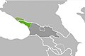
 AutonomousRepublicOfAbkhazia.svg 1,294 × 820; 6.01 MB
-
 Barmysh.JPG 942 × 1,140; 104 KB
-
 Blabyrkhua.JPG 942 × 1,140; 104 KB
-
 Blank Map of Abkhazia.png 662 × 499; 3 KB
-
 Caucasus Political.png 10,299 × 7,807; 5.87 MB
-
 Caucasus Region 26-08-08.PNG 3,119 × 2,392; 10.57 MB
-
 Circassia in 1750.png 800 × 533; 138 KB
-
 CountriesRecognizing-SouthOssetia-Abkhazia.png 1,425 × 625; 33 KB
-
 CountriesRecognizingAbkhazia&SouthOssetia.png 1,357 × 628; 53 KB
-
 Diplomatic missions in Abkhazia.svg 940 × 415; 1.42 MB
-

-

-
 División administrativa de Abjasia.png 600 × 450; 62 KB
-
 Duripsh.JPG 942 × 1,140; 104 KB
-
 ICG Map of Western Georgia.JPG 776 × 635; 68 KB
-

-
 Kaldakhuara.JPG 942 × 1,140; 104 KB
-
 Khuap.JPG 942 × 1,140; 104 KB
-
 Khypsta.JPG 942 × 1,140; 104 KB
-
 Localisation de l'Abkhazie.svg 593 × 606; 666 KB
-
 Lykhny.JPG 942 × 1,140; 104 KB
-
 Map of Abkhazia (1992-1995).png 600 × 450; 66 KB
-

-
 Map of Abkhazia.jpg 635 × 425; 59 KB
-
 Map of Community for Democracy and Rights of Nations.png 655 × 600; 244 KB
-
 Mapofsamurzakan.png 332 × 416; 41 KB
-
 Mcara.JPG 942 × 1,140; 104 KB
-
 Merkheuli Locator.png 300 × 415; 40 KB
-
 Mezinárodní uznání Abcházie a Jižní Osetie.png 940 × 415; 115 KB
-
 Mezinárodní uznání Abcházie.svg 940 × 415; 1.68 MB
-
 Mgudzyrkhua.JPG 942 × 1,140; 104 KB
-
 Mysra.JPG 942 × 1,140; 104 KB
-
 Othara.JPG 942 × 1,140; 104 KB
-

-
 Russian occupied territories in map.svg 3,840 × 1,935; 428 KB
-
 Russian recognition of european post-sovietic territories early 2014.svg 680 × 520; 683 KB
-
 Russian-occupied territories in map.jpg 3,840 × 1,935; 640 KB
-
 Russian-occupied territories in map.webp 1,220 × 614; 40 KB
-
 Situtation in Georgia (country).svg 1,715 × 913; 262 KB
-
 Sketch-1642508226622.jpg 1,080 × 711; 18 KB
-
 Sketch-1642511199116.png 1,080 × 711; 86 KB
-
 TSFSR(Trans-Caucasian SFSR1921 1926-s).jpg 1,200 × 762; 276 KB
-
 Un-Abkhazia mep (heb).PNG 1,382 × 1,249; 309 KB
-
 Zahraniční vztahy Abcházie.svg 940 × 415; 1.68 MB
-
 Zvandripsh.JPG 942 × 1,140; 104 KB
-
 АРА на административной карте Грузии.png 800 × 448; 107 KB
-
 מפת אבחזיה (A).PNG 936 × 747; 146 KB
-
 מפת אבחזיה.PNG 1,016 × 953; 173 KB
-
 נפות אבחזיה (heb).png 600 × 450; 66 KB
-
 סמגרלו, סוואנתי וחלק מאבחזיה.PNG 1,243 × 616; 176 KB


.jpg)


.png)


.png)


.svg)


.PNG)


.PNG)

.png)
