
Category:Locator maps of Cyprus
Subcategories
This category has the following 2 subcategories, out of 2 total.
!
B
- Bilateral maps of Cyprus (117 F)
Media in category "Locator maps of Cyprus"
The following 24 files are in this category, out of 24 total.
-
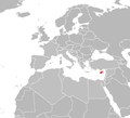
 Cyprus (orthographic projection).png 2,000 × 2,000; 663 KB
-
 Cyprus - Location Map (2013) - CYP - UNOCHA.svg 250 × 250; 652 KB
-
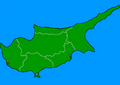
 Cyprus Locator.png 1,160 × 1,056; 64 KB
-
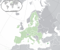
 EU location CYP magnified.png 1,600 × 1,200; 629 KB
-
 EU location CYP.png 1,600 × 1,200; 867 KB
-
 EU-Cyprus highlighted.svg 2,182 × 1,834; 2.15 MB
-
 EU-Cyprus.svg 2,045 × 1,720; 7.31 MB
-
 Europe cyprus.svg 680 × 520; 795 KB
-
 Europe map cyprus.png 1,231 × 929; 51 KB
-
 Fig Tree Bay Map.png 599 × 366; 18 KB
-
 Limassol location Map.png 599 × 366; 15 KB
-
 Location Cyprus EU Europe.png 2,056 × 1,800; 378 KB
-
 Location Cyprus in EU.PNG 2,056 × 1,710; 530 KB
-
 LocationCyprus.png 250 × 115; 6 KB
-
 LocationCyprus2.png 1,000 × 500; 149 KB
-
 Map Coral Bay.png 599 × 366; 18 KB
-
 Map of Venetian Cyprus.svg 512 × 349; 4 KB
-
 Nissi beach location map.png 599 × 366; 18 KB
-
 Norhern Cyprus (orthographic projection).png 2,000 × 2,000; 658 KB
-
 Northern Cyprus (ortographic projection).png 2,000 × 2,000; 659 KB
-
 Paphos map.PNG 450 × 320; 7 KB
-
 Polis Chrisoxous 2025.png 1,541 × 1,840; 104 KB
-
 Vasilikos Map.png 599 × 366; 15 KB
-
 World Factbook (1982) Cyprus.jpg 590 × 590; 76 KB
.png)
_-_CYP_-_UNOCHA.svg)


.png)
.png)


_Cyprus.jpg)