
Category:English-language maps of the Netherlands
Subcategories
This category has the following 2 subcategories, out of 2 total.
H
- Holland 1-25,000 (80 F)
Media in category "English-language maps of the Netherlands"
The following 9 files are in this category, out of 9 total.
-
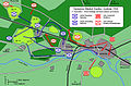
 Arnhem Map 1.jpg 2,000 × 1,323; 1.03 MB
-
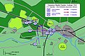
 Arnhem Map 2.jpg 2,000 × 1,323; 1.16 MB
-
 Arnhem Map 3.jpg 2,000 × 1,323; 1.15 MB
-
 Arnhem Map 4.jpg 2,000 × 1,323; 1.05 MB
-
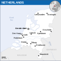
 Base Map of the Netherlands.png 752 × 1,006; 372 KB
-
 Map of the Netherlands - btv1b8459866r.jpg 8,292 × 9,430; 10.23 MB
-
 Netherlands - DPLA - 8daaae71e6cd5e9c590234a9af997c17.jpg 2,394 × 3,122; 7.78 MB
-
 Netherlands - Location Map (2013) - NLD - UNOCHA.svg 250 × 251; 905 KB
-
 PAT - Netherlands.gif 830 × 1,035; 116 KB


_-_NLD_-_UNOCHA.svg)
