
Category:English-language maps of Iran
Subcategories
This category has the following 4 subcategories, out of 4 total.
Media in category "English-language maps of Iran"
The following 91 files are in this category, out of 91 total.
-
 Ardabil.svg 370 × 790; 341 KB
-
 Caucacus Hotspot 2005 Print.tif 903 × 772; 2.03 MB
-
 Chaharmahal and Bakhtiari.svg 740 × 780; 146 KB
-
 Cities of Kohgiluyeh and Boyer-Ahmad Province - 2.png 1,846 × 1,477; 146 KB
-
 Cities of Kohgiluyeh and Boyer-Ahmad Province.png 1,846 × 1,477; 165 KB
-
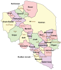
 Counties of kohgiluyeh and boyer ahmad by english name.svg 826 × 557; 222 KB
-
 Counties of Kohgiluyeh and Boyer-Ahmad Province - 2.png 1,846 × 1,477; 143 KB
-
 Counties of Kohgiluyeh and Boyer-Ahmad Province.png 1,846 × 1,477; 160 KB
-
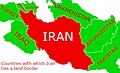 Countries with which Iran has a land border.jpg 462 × 282; 94 KB
-
 Damavand County Map.png 620 × 423; 15 KB
-
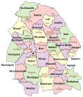
 Districts of kohgiluyeh and boveir ahmad counties by english name.svg 703 × 557; 272 KB
-
 Diversity-14-00724-g001.png 2,998 × 2,230; 3.58 MB
-
 ECHO Iran Editable A4 Landscape.pdf 1,754 × 1,239; 533 KB
-
 ECHO Iran Editable A4 Landscape.png 1,123 × 794; 465 KB
-
 Ganj dareh.jpg 400 × 574; 240 KB
-
 Gawerk-Mohsen Rashidi.jpg 2,065 × 1,710; 687 KB
-
 Gawerk-ایل گورک-بلباس-Bilbas-MohsenRashidi.jpg 1,897 × 881; 233 KB
-
 Geographic map of the Lut Desert.png 864 × 592; 707 KB
-
 Gilan Map.svg 512 × 534; 63 KB
-
 Gilan.svg 650 × 780; 393 KB
-
 Golestan.svg 950 × 780; 216 KB
-
 GSTP Incubation Centers.jpg 950 × 683; 174 KB
-
 Hamadan - Asadabad sharestan.png 658 × 817; 74 KB
-
 Hamadan-Bahar sharestan.png 658 × 817; 76 KB
-
 Hamadan-Hamadan sharestan.png 658 × 817; 75 KB
-
 Hamadan-Kaburadahang sharestan.png 658 × 817; 76 KB
-
 Hamadan-Malayer sharestan.png 658 × 817; 77 KB
-
 Hamadan-Nahavand sharestan.png 658 × 817; 77 KB
-
 Hamadan-Razan sharestan.png 658 × 817; 77 KB
-
 Hamadan-Tuyserkan sharestan.png 658 × 817; 75 KB
-
 Hamadan.svg 630 × 780; 378 KB
-
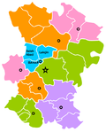
 Hamedan Map - En.svg 822 × 980; 372 KB
-
 IR Railways.JPG 476 × 367; 33 KB
-
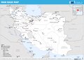
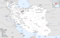 Iran Base Map.png 1,108 × 702; 516 KB
-
 Iran Oil and Gas Fields.png 583 × 767; 84 KB
-
 Iran oil concession.png 2,916 × 3,125; 1.28 MB
-
 Iran old-new provinces.png 1,281 × 878; 66 KB
-
 Iran provinces and counties 1956 English.svg 2,074 × 2,059; 357 KB
-
 Iran railway 2011.png 740 × 600; 130 KB
-
 Iran railway.png 740 × 616; 129 KB
-
 Iran- Gendarmerie Units - February 1951 - DPLA - 88b8e8668385d9fefb3afa29f49c7014.jpg 4,772 × 4,800; 792 KB
-
 Iran-map 7.jpg 800 × 806; 129 KB
-
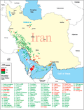
 Iran-Map En.jpg 672 × 581; 122 KB
-

-
 IranOMC.png 930 × 788; 53 KB
-
 Iranprovincetemplatefootball.png 706 × 427; 95 KB
-
 Isfahan - grey.svg 698 × 457; 155 KB
-
 Isfahan counties.svg 1,070 × 730; 524 KB
-
 Kerman.svg 680 × 780; 401 KB
-
 Kermanshah.svg 960 × 670; 389 KB
-
 Khuzestan.svg 664 × 780; 440 KB
-
 Kohgiluyeh and Boyer-Ahmad.svg 860 × 780; 311 KB
-
 Kurdistan (Iran).svg 960 × 780; 169 KB
-
 Kurdistan Province districts map (with labels).svg 1,980 × 1,530; 3.35 MB
-
 Lake low resolution.jpg 2,892 × 2,276; 1.95 MB
-
 LavanLocation.png 1,170 × 814; 26 KB
-
 Linguistic Map of Golestan Province.jpg 1,024 × 768; 273 KB
-
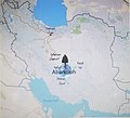 Location of Abarkuh Cypress.jpg 2,001 × 1,810; 1.5 MB
-
 Lorestan.svg 960 × 620; 353 KB
-
 Map of Iran in ME.jpg 1,023 × 575; 55 KB
-
 Map of north of Iran.jpg 909 × 547; 83 KB
-
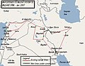
 Map of northern Iran under the Sasanians.jpg 1,211 × 623; 870 KB
-
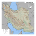 MapOfIran.png 3,568 × 3,568; 9.7 MB
-
 Mihrabanids 1236–Mid-16th century.png 620 × 429; 18 KB
-
 Mukriyan in West Azerbijan.png 1,256 × 968; 249 KB
-
 Neolithic sites in Iran.jpg 1,162 × 855; 105 KB
-
 PAT - Iran.gif 920 × 920; 305 KB
-
 Persian Language map.png 1,109 × 721; 16 KB
-
 Picture of Hamadan.png 485 × 318; 50 KB
-
 Political map of Khoy.jpg 1,080 × 1,080; 267 KB
-
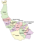
 Populated County (West Azarbijan) Iran.png 1,700 × 1,800; 225 KB
-
 Qazvin.svg 960 × 770; 271 KB
-
 Shatt al arab.png 500 × 391; 27 KB
-
 Soviet invasion of Iran (Threads).png 300 × 263; 8 KB
-
 Strait of Hormuz 2004.png 979 × 893; 1.72 MB
-
 Strait of Hormuz.jpg 583 × 357; 54 KB
-
 TCBR NDZ.jpg 1,000 × 707; 195 KB
-
 TCBR TASA.jpg 1,000 × 707; 198 KB
-
 TCBR TBZR.jpg 1,000 × 707; 197 KB
-
 TCBR TQCN.jpg 1,000 × 707; 197 KB
-
 Tehran Province location map (with labels).svg 1,980 × 1,035; 324 KB
-
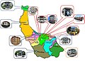
 Tehran Province Names.png 872 × 439; 43 KB
-
 Tehran.svg 980 × 520; 395 KB
-
 TGSR NDZ.jpg 1,000 × 707; 189 KB
-
 TQCN TASA.jpg 1,000 × 707; 193 KB
-
 Un-iran.png 3,534 × 3,174; 3.03 MB
-
 West Azerbaijan.svg 530 × 790; 673 KB
-
 Zanjan.svg 820 × 780; 286 KB
-
تاریخ ایران.webm 1 min 20 s, 1,280 × 720; 2.76 MB
-
 شهرستان چرام - choram county - 4.png 1,846 × 1,477; 133 KB
-
 مهم ترين بنادر ايران.gif 801 × 614; 36 KB


.jpg)


.svg)
.svg)


_Iran.png)


.png)


.svg)


