
Category:English-language maps of Honduras
Countries of the Americas: Argentina · Belize · Bolivia · Brazil · Canada · Chile · Colombia · Costa Rica · Cuba · Dominican Republic · Guatemala · Guyana · Haiti · Honduras · Jamaica · Mexico · Nicaragua · Peru · United States · Uruguay · Venezuela
Other areas: French Guiana · Greenland · Guadeloupe
Other areas: French Guiana · Greenland · Guadeloupe
Subcategories
This category has only the following subcategory.
Media in category "English-language maps of Honduras"
The following 6 files are in this category, out of 6 total.
-
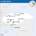 Hondura - Location Map (2013) - HND - UNOCHA.svg 250 × 250; 284 KB
-
 Honduras - DPLA - 6b6bbf4ab65ad6af71dd47d5f2b68803.jpg 4,944 × 2,973; 1.33 MB
-
 Honduras - Nicaragua Transportation - DPLA - 0f6f8c42d2e8a84c40d4454a5531b879.jpg 5,640 × 5,046; 2.57 MB
-
 Honduras Population Distribution - DPLA - 340fa14384b2aebdb319d0bd60ce3ed3.jpg 4,935 × 3,569; 1.95 MB
-
 Honduras. LOC 2011586144.jpg 4,116 × 3,291; 1.74 MB
-
 Honduras. LOC 84694131.jpg 9,496 × 6,354; 7.78 MB
_-_HND_-_UNOCHA.svg)


