
Category:English-language SVG maps showing history
Subcategories
This category has the following 3 subcategories, out of 3 total.
Media in category "English-language SVG maps showing history"
The following 120 files are in this category, out of 120 total.
-
 1263 Mediterranean Sea.svg 925 × 424; 704 KB
-
 14 Century BC Middle East - en.svg 1,001 × 557; 137 KB
-
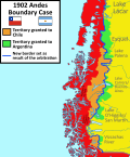 1902 Andes Boundary Case.svg 1,430 × 1,720; 1.47 MB
-
 Acadia 1754 map.svg 1,573 × 1,100; 572 KB
-
 Acadia 1754.svg 1,573 × 1,260; 592 KB
-
 Acadians 1754 map.svg 1,573 × 1,100; 534 KB
-
 Acadians 1754.svg 1,573 × 1,230; 550 KB
-
 Achaemenid Empire En.svg 1,500 × 680; 2.03 MB
-
 Admiral Yi Sunshin's Naval campaigns in 1592.svg 792 × 612; 4.3 MB
-
 Anaximander world map (mul).svg 1,134 × 1,134; 21 KB
-
 Ancient Egypt Map - en (Ancient Egyptian & Greek Names).svg 1,577 × 3,219; 430 KB
-
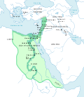
 Ancient Egypt map-en.svg 1,577 × 3,219; 750 KB
-
 AreasOfHabiruActivityInAmarnaLettersLBIIA.svg 1,500 × 1,000; 620 KB
-
 Atlanta campaign.svg 900 × 1,052; 138 KB
-
 Attack on Ayutthaya (1549).svg 1,107 × 883; 224 KB
-
 Barge T-36 drift and rescue - en.svg 1,770 × 925; 230 KB
-
 Basin of Mexico 1519 map-en.svg 1,412 × 1,883; 551 KB
-
 Battle of Anglon 543 map 1.svg 744 × 1,052; 118 KB
-
 Battle of Anglon 543 map 2.svg 744 × 1,052; 129 KB
-
 Battle of Bronkhorstspruit troop movements.svg 699 × 498; 2.02 MB
-
 Battle of Dayr al-'Aqul.svg 820 × 650; 884 KB
-
 Battle of Flamborough Head map as of 23 September 1779.svg 183 × 450; 48 KB
-
 Battle of hastings1.svg 1,052 × 744; 105 KB
-
 Battle of Muret Map - en.svg 746 × 746; 55 KB
-
 Battle of Poitiers 1356 map-en.svg 1,704 × 1,467; 1.64 MB
-
 Battle of Sourton Down a.svg 836 × 511; 1.18 MB
-
 Battle of the Bulge progress.svg 1,001 × 905; 114 KB
-
 Battle of Tolbiac map-en.svg 787 × 607; 692 KB
-
 Battle of Yarmouk Day Three.svg 3,575 × 2,000; 1.9 MB
-
 Battle Philippine sea map-en.svg 732 × 671; 161 KB
-
 Battle Trebia-en.svg 999 × 755; 96 KB
-
 Bronze-age-collapse.svg 1,162 × 888; 252 KB
-
 C+B-Jerusalem-Map2-WallsAndContours.svg 945 × 1,499; 395 KB
-
 Campaign.of.La.Sierra.1883.svg 709 × 897; 518 KB
-
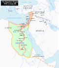
 Canal of the Pharaohs Map-en.svg 684 × 738; 33 KB
-
 Christian states 495 AD (en).svg 2,436 × 1,372; 3.61 MB
-
 Colombia (Miranda) y Congreso de Panamá (Bolívar).svg 2,275 × 2,052; 679 KB
-
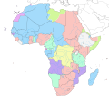 Colonial Africa 1913 map.svg 1,390 × 1,295; 660 KB
-
 Conceptions Colomb map-en.svg 1,022 × 635; 857 KB
-
 Construction of the Yamanote Line en.svg 392 × 383; 29 KB
-
 Crystal modes multilingual.svg 373 × 1,100; 12 KB
-
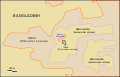 Dahala Khagrabari en.svg 695 × 444; 6 KB
-
 Dahala Khagrabari English.svg 695 × 444; 6 KB
-
 Decolonization - World In 1945 en.svg 1,421 × 816; 802 KB
-
 Egypt 1450 BC.svg 1,300 × 1,500; 257 KB
-
 Egypt NK edit.svg 1,282 × 1,501; 252 KB
-
 Falklands War - Distances to bases.svg 746 × 1,050; 1.51 MB
-
 Florida war 1837 - en.svg 1,153 × 1,500; 369 KB
-
 Formative Era sites.svg 629 × 459; 100 KB
-
 German WWII on West Pacific Ocean map-en.svg 1,322 × 1,281; 118 KB
-
 Germans attacks on Nauru-en.svg 1,312 × 932; 49 KB
-
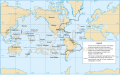
 Great white fleet map.svg 3,389 × 2,537; 1.9 MB
-
 Hecataeus world map-en.svg 825 × 803; 85 KB
-
 Hitt Egypt 1450 bc.svg 1,300 × 1,500; 248 KB
-
 Inchon landing map (en).svg 702 × 462; 120 KB
-
 Italian East Africa (1938–1941).svg 1,012 × 908; 147 KB
-
 Laurasia-Gondwana.svg 519 × 435; 31 KB
-
 Les Micmacs (multilingual).svg 3,387 × 2,113; 455 KB
-
 Maneuvers prior to the battle of Poitiers 1356 map-en.svg 450 × 550; 42 KB
-
 Map Battle of the Nile 1798-en.svg 610 × 880; 1.2 MB
-
 Map Bolivia territorial loss-en.svg 375 × 355; 78 KB
-
 Map Byzantine Empire 1025-en.svg 1,963 × 1,104; 960 KB
-
 Map of Ancient Rome 271 AD.svg 2,050 × 1,213; 207 KB
-
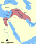 Map of fertile crescent.svg 1,987 × 2,441; 729 KB
-
 Map of Rome and Carthage at the start of the Second Punic War.svg 1,067 × 768; 406 KB
-
 Map of the Ancient Rome at Caesar time (with conquests)-en.svg 1,674 × 1,018; 2.8 MB
-
 Map of the Battle of Tinian (1944).svg 486 × 577; 493 KB
-
 Map of the Erivan Khanate in 1820.svg 3,748 × 2,188; 2.11 MB
-
 Map of the Falaise Pocket.svg 628 × 939; 333 KB
-
 Map of the Karabakh Khanate 2.svg 1,711 × 1,384; 1.28 MB
-
 Map of the Karabakh Khanate.svg 1,711 × 1,384; 2.31 MB
-
 Map Thirteen Colonies 1775.svg 914 × 628; 325 KB
-
 Mexican–American War (without Scott's Campaign)-en.svg 1,433 × 1,230; 610 KB
-
 Mexican–American War-en.svg 1,571 × 1,230; 675 KB
-
 Modern Empires - en.svg 4,371 × 2,284; 3.42 MB
-
 Nashville64.svg 744 × 1,052; 85 KB
-
 Near East 400BC.svg 2,102 × 1,510; 4.7 MB
-
 Near East 500BC.svg 2,102 × 1,510; 4.81 MB
-
 Near East 600BC.svg 2,102 × 1,510; 4.93 MB
-
 Nouvelle-France map-en.svg 1,530 × 1,090; 586 KB
-
 OldestCitiesContinuouslyInhabitedInAfrica.svg 1,403 × 1,074; 890 KB
-
 OldestContinuouslyInhabitedCitiesInTheAmericas.svg 1,264 × 1,046; 876 KB
-
 Operation Searchlight in Dhaka en.svg 395 × 460; 243 KB
-
 Overall Plan Nicopolis-en.svg 1,128 × 858; 67 KB
-
 Pacific Area - Imperial Powers 1939 - Map.svg 1,039 × 814; 4.44 MB
-
 Pacific Area - The Imperial Powers 1939 - Map.svg 1,039 × 814; 4.54 MB
-
 Peninsule acadienne (multilingue).svg 1,180 × 825; 1.21 MB
-
 Periplous of the Erythraean Sea.svg 1,280 × 903; 1.43 MB
-
 Plan de la bataille d'Arsouf-en.svg 756 × 1,737; 24 KB
-
 Plan forum dougga-en.svg 2,753 × 2,081; 109 KB
-
 Polynesian Migration.svg 551 × 551; 658 KB
-
 Ptolemaic Alexandria - en.svg 1,702 × 1,065; 54 KB
-
 Ptolemaic Kingdom III-II century BC - en.svg 2,191 × 1,679; 654 KB
-
 Roman Empire 69.svg 2,228 × 1,675; 677 KB
-
 RomanEmpire 117 - Earliest locations of Mithraism.svg 2,180 × 1,600; 1.87 MB
-
 RomanEmpire 117 - Moesia Superior and Moesia Inferior.svg 2,180 × 1,600; 1.87 MB
-
 RomanEmpire 117 recoloured 2.svg 2,180 × 1,600; 1.09 MB
-
 RomanEmpire 117 recoloured.svg 2,180 × 1,600; 1.11 MB
-
 RomanEmpire 117.svg 512 × 376; 704 KB
-
 Scott's campaign-en.svg 1,411 × 541; 71 KB
-
 Second Congo War Africa map en.svg 1,525 × 1,440; 992 KB
-
 Second Punic War full-en.svg 770 × 485; 770 KB
-
 Semitic 1st AD.svg 636 × 653; 120 KB
-
 Semitic languages.svg 712 × 917; 1.15 MB
-
 Septième croisade-en.svg 512 × 303; 461 KB
-
 Siege of Cartagena 209 BC.svg 512 × 658; 91 KB
-
 Silk Road in the I century AD - en.svg 1,544 × 907; 869 KB
-
 Sinyavino Offensive, September 10, 1942.svg 834 × 733; 66 KB
-
 South Africa Border War map.svg 671 × 474; 262 KB
-
 Spanish North America.svg 5,088 × 5,084; 16.3 MB
-
 SpanishEmpire1790.svg 4,327 × 2,194; 5.67 MB
-
 Territorial Expansion of Russia.svg 1,944 × 1,511; 1.11 MB
-
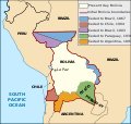
 Territorial losses of the Republic of Chile de jure.svg 1,800 × 2,808; 3.77 MB
-
 Treaty of Küçük Kaynarca.svg 1,070 × 357; 172 KB
-
 Triangular trade en.svg 968 × 684; 760 KB
-
 Val ès Dunes battle-en.svg 1,434 × 837; 70 KB
-
 Wacht am Rhein map (Opaque).svg 557 × 900; 217 KB
-
 Wacht am Rhein map.svg 557 × 900; 216 KB
-
 Washington's retreat across New Jersey 1776 - en.svg 1,393 × 1,393; 1.27 MB
-
 Western Asia Minor Greek Colonization.svg 744 × 1,052; 809 KB


.svg)
.svg)


.svg)


.svg)
_y_Congreso_de_Panam%C3%A1_(Bol%C3%ADvar).svg)


.svg)
.svg)

.svg)


-en.svg)
.svg)


-en.svg)


.svg)


.svg)


