
Category:Cosumnes River
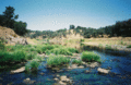
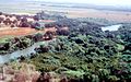
English: The Cosumnes River flows from the central Sierra Nevada, through the northern San Joaquin Valley, to the Sacramento-San Joaquin Delta tidelands.
river in the United States of America   | |||||
| Upload media | |||||
| Instance of | |||||
|---|---|---|---|---|---|
| Location | California, Pacific States Region | ||||
| Length |
| ||||
| Mouth of the watercourse | |||||
| Drainage basin | |||||
 | |||||
Media in category "Cosumnes River"
The following 14 files are in this category, out of 14 total.
-

-
 Cosumnes River (drone).jpg 4,032 × 2,268; 7.83 MB
-
 Cosumnes.gif 574 × 375; 137 KB
-
 Cosumnes1.jpg 2,008 × 1,258; 236 KB
-
 Cosumnesmap.png 2,083 × 1,458; 921 KB
-
 CosumnesNF.jpg 921 × 690; 1.3 MB
-
 Hermit's Path (50639032787).jpg 6,000 × 4,000; 15.98 MB
-
 North Fork Cosumnes River (54617350067).jpg 9,504 × 6,336; 65.44 MB
-
 North Fork Cosumnes River (54618229146).jpg 8,342 × 5,310; 31.22 MB
-
 Slug Gulch - Middle Fork of Cosumnes River (53156710432).jpg 4,866 × 6,082; 31.51 MB
-
 Lorquin's admiral (cropped).jpg 1,172 × 975; 376 KB
-
 Lorquin's admiral.jpg 1,600 × 1,158; 393 KB
-
 Brodiaea.jpg 700 × 773; 245 KB
-
 Wpdms usgs photo sacramento delta 2.jpg 700 × 520; 81 KB
.jpg)
.jpg)


.jpg)
.jpg)
.jpg)
.jpg)
.jpg)


